Real-Time Demonstrations of WDSS-II
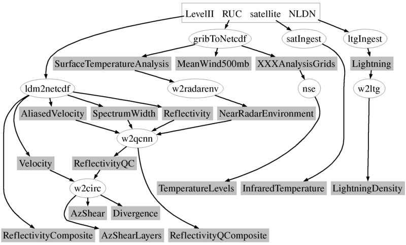
Several agencies and private companies license WDSS-II to run it in real-time. If you are interested in 24/7 availability, and products customized to your requirements, we recommend that you license the software and run it in your data center.We do run a set of WDSS-II algorithms, shown in the schematics on this page, in real-time at NSSL/OU. This is a research system, and is not guaranteed to be available 24/7. If we want to try out a new idea, this is where we will try it out, so if you want consistent data, do not use this data feed .
 If you are interested in using real-time data for research,
contact us and we can discuss the options.
If you are interested in using real-time data for research,
contact us and we can discuss the options.
Here are some links showing WDSS-II in real-time situations. Since these are real-time pages, you may or may not see interesting weather there.
- This Google Earth page shows you a number of our real-time demos. Google Earth is a free download from Google.
- Snapshots from our CONUS real-time system, comprising data from 140 radars, satellites, mesonet, surface observations, etc. CONUS Domain
- A Phased Array Radar is being used to study weather. WDSS-II is used to display images from this experimental radar.
- The prototype Polarimetric radar (KOUN). There are links on the web page that show a comparison with the Doppler (non-polarimetric) weather radar (KTLX).